Main Components
Here is a list of the main components of OrbisGIS. Except for the map, all these components are considered by OrbisGIS as plugins. So they can be:
- made visible or not (just close the component to hide it),
- resized (using the cursor of your mouse),
- moved (drag & drop the component to a new place in the UI),
- (un)docked (pretty useful if you have a dual screen),
- (un)installed (thanks the plugin manager).
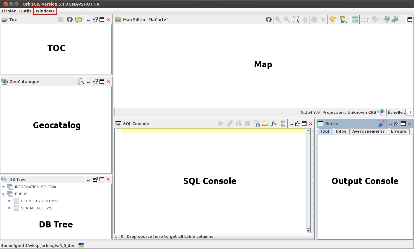
To load a component, check the list in the “Windows” menu (in red in the illustration above) or the “Tools” menu (for the SQL Console).
Geocatalog
The Geocatalog (  ) is the place where datasources are managed. Through a right-click in the blank area, the user can:
- Add a datasource (a file
 or a folder
  ),
), - Import a datasource (a file or a folder),
- Export layers into flat files or databases (
 ),
), - Show the attributes tables (
 ),
), - Remove a datasource (
 ),
), - Clear the Geocatalog : all the sources are removed from OrbisGIS,
- Refresh the list (
 ).
).
Map
The map (  ) is the place where geographic informations (vector or raster) are displayed. The user can navigate into the map (using zoom or pan tools), select and get informations on objects.
TOC
TOC (  ) stands for “Table Of Content”. This component allows the user to:
- Make visible or not the layer with the checkbox (on the left),
- Change the layer name –> make a double-click on the layer. Then change the name and press “Entrer”,
- Change the order of layers –> drag & drop the layer upward or downward,
- Add WMS layers (
 ),
), - Add a layer group ( ).
Moreover, several features are available via a right-click:
- Show attributes ( ): show the attributes’s table,
- Zoom to the layer (
 ): Extended zoom on the layer,
 - Import a style (
 ), *
), * - Create a thematic analysis (
 ), *
), * - Edit (
 ), delete (
  ) or export (
  ) an existing style, *
 - Remove the layer ( ): Remove the layer from the TOC,
- Start edition (
 ): To edit a layer (e.g: add a field, delete an object, …).
* see Cartography.
DB Tree
The DB Tree (  ) is a tree representation of all the layers loaded in OrbisGIS. Layers (tables) are listed into their respectives folder (schema).
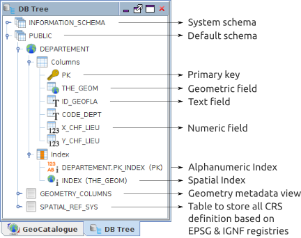
Specific options allows the user to:
- Create spatial index (
 ),
), - Create alphanumeric index (
 ),
), - Remove columns ( ).
Output console
The output (  ) console is the place where all messages (informations, warnings or errors) are displayed.
Logs can be copy and paste into a text editor.
SQL console
The SQL console (  ) is the place where the user can process data thanks to SQL scripts. To know more about this component, read “SQL Console”.